Heat Safety
40+ households arecontributing real-time data to confront rising heat risks.
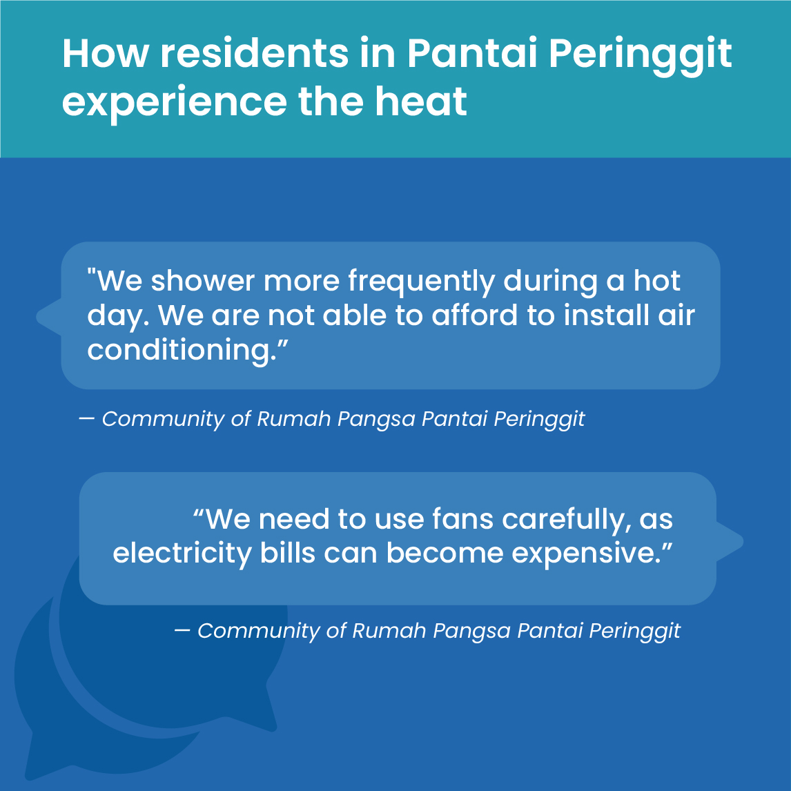
Residents in Pantai Peringgit are helping capture heat data that is closing key information gaps.
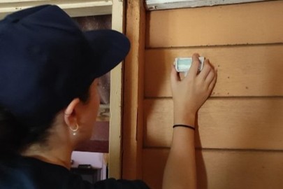
Heat sensors installed in over 40 homes record indoor and outdoor temperatures day and night.
Data helps identify which buildings and times of day are hottest — showing where cooling is most urgent.
Findings guide the city and residents in choosing practical solutions like reflective paint and tree planting.
To build a picture of each community, the Resilience for Communities (R4C) program used risk mapping, open-data sources, expert interviews, community surveys and focus groups. This assessment used the Climate Resilience Measurement for Communities (CRMC) tool to assess community resilience to extreme heat and flooding - helping to identify priorities and design solutions.
Sources of resilience — Community-led heat monitoring strengthens the community's human, social and financial capital.
Builds residents’ understanding of how heat affects their health and daily comfort.
Connects neighbours, local leaders, and researchers through shared data and dialogue.
Guides cost-effective investments in cooling and greening where they are most needed.
Impact multipliers — Resilience solutions have a different mix of impact multipliers and impact multiple systems, businesses and societies. Together, multipliers produce anamplified impact.
Improved public health
Tracking indoor heat protects vulnerable groups, especially when nighttime temperatures stay dangerously high.
Access to cool spaces
Data guides cooling solutions like reflective paint and greening.
Community cohesion
Shared involvement builds trust, ownership and collaboration.
How does this solution make a difference? – Addressing prioritized shocks and stresses
Climate change
Heat Exposure
Community awareness
Closing knowledge gaps
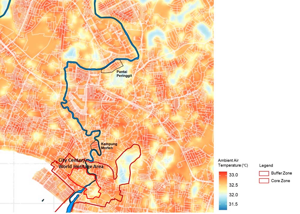
Data from Melaka’s nearest meteorological station shows lower temperatures than residents actually experience, as heat concentrates in neighborhoods with limited vegetation and homes offering little protection. By measuring heat inside houses and on the streets, the project captures real risks and provides evidence to guide targeted interventions and city planning.
Revealing hidden risks
Indoor temperatures in Pantai Peringgit often rise above 30°C, with dangerous night-time heat that prevents residents from resting. Community sensors make these risks visible, ensuring protective measures focus where families are most exposed.
Melaka’s urban heat island map –Integrated Valuation of Ecosystem Services and Trade-offs Modelling
Source: Ramsay and Hamel, "RapidHeat Assessment: Melaka, Malaysia" (Nanyang Technological University,2024)
Indoor and Outdoor Temperature in Pantai Peringgit
(Source:Community Heat Assessment collaboration with Nanyang Technological University, 2024)